


Description
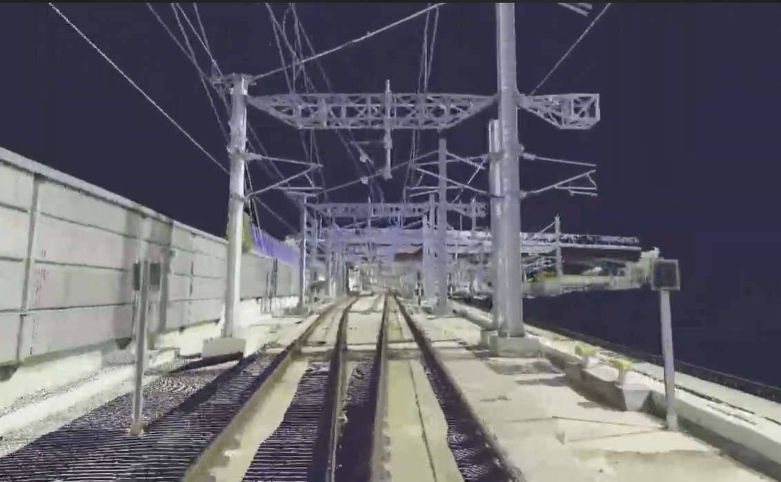
LiDAR technology is key to digitizing infrastructure such as bridges, railways, roads, tunnels and buildings. Using laser pulses to create detailed 3D models, LiDAR offers millimeter accuracy and captures data in real time.
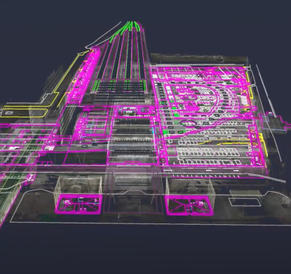
Among the benefits are the speed of capture, the massive acquisition of data in a single measurement, which facilitates predictive maintenance and improves the performance of engineering companies in their projects. Projects for extraction of elements or generation of Digital Twin so important in the efficient maintenance of infrastructures.
LiDAR uses lasers to measure distances to objects and surfaces, generating a point cloud that allows the creation of highly detailed, geo-referenced 3D representations. This is especially useful in the digitization of infrastructure, as it allows the shape, size and characteristics of complex structures to be captured with millimeter precision.
Benefits of LiDAR technology in infrastructure
- Accuracy and detailLiDAR generates extremely accurate 3D models, resulting in reliable georeferenced and complete data.
- Capture speedThis technology allows the collection of large volumes of data in a reduced time, which facilitates rapid inspections without interrupting the operation of the infrastructure.
- Accessibility to complex areasLiDAR can capture information in areas that are difficult to access, such as bridges, tunnels and mountainous terrain, without the need for direct contact.
- Improved planning and maintenanceLiDAR data enables engineers to plan maintenance and repairs more effectively, optimizing resources and extending the life of structures.
Services offered:
- Road Infrastructure Rail Infrastructure
- Maximum speed studies in curves. Automatic checking of tunnel gauges.
- Automatic checking of gauges. Catenary pole/portal identification.
- Generation of surfaces/calculation of volumes for clearings. Alignment status
- Radii of curvature, superelevations and gradients. Radii of curvature, superelevations and gradients.
- Verification of height and shape of road protections. Vectorization of catenary
- Automatic extraction of vertical and horizontal signage and acquisition of axes
- Axle geometry. Track gauge
- Extraction of white and break lines. Removal of rails
- BIM modeling of track/platform, stations or structures
With extensive experience in the implementation of advanced solutions, we have consolidated LiDAR technology as a key tool in infrastructure digitization. Our experience allows us to provide accurate and reliable data, significantly improving the planning, maintenance and safety of projects in various sectors. Thanks to our experience and expertise in this technology, we guarantee optimal results that optimize the management of critical infrastructures.
Other products you may be interested in
More information about Lidar for Digitizing
LiDAR (Light Detection and Ranging) technology has revolutionized the way infrastructure digitizing is done. Using laser pulses to measure precise distances and create detailed 3D models, LiDAR has become a key tool for the planning and maintenance of infrastructure such as roads, bridges, buildings and rail networks. This technology can accurately capture the geometry of infrastructure in real time, facilitating more efficient and safer decision-making.
LiDAR technology applications
- Bridge inspection and maintenance: Allows obtaining an accurate geometry of the bridge of its current condition.
- Road digitization: LiDAR scanning of roads facilitates the creation of detailed maps, improving traffic planning and repairs.
- Digitization of railway infrastructure: Obtaining the georeferenced point cloud in order to extract georeferenced elements from it.
- Civil engineering and construction: LiDAR is used in the creation of 3D models of land and buildings, facilitating the planning of new construction projects.
